The Rio Grande’s Boquillas Canyon
We were standing on a sandbar on the Texas side of the Rio Grande, completely naked, dripping wet, rummaging through our bags for some warm, dry clothes. We felt disoriented, but at the same time relieved to be almost back in control. Lisa and I expected unpredictable challenges during our multi-day canoe trip, but this was the first time we had to face our fear of capsizing a fully-loaded boat in the backcountry.
There were several canyons to pick from in Texas’s Big Bend National Park. Lisa and I chose to canoe Boquillas Canyon; a thirty-three mile calm section with few rapids. It’s not that we avoided rapids; we normally enjoyed the challenge of canoeing class IIs and IIIs. But not in December, when our risk of exposure was increased due to the chillier water temperatures. The thought that excited us the most about this section was the fact that, once we floated into the inaccessible and rugged canyon, there wouldn’t be any modern communications, no civilization, and very little contact with other people.
Getting Started
I was prepared to load our seventeen-foot Old Town canoe onto the foam roof racks. But first, we had to load Lisa’s car with what seemed to be an excessive heap of gear. Lisa tends to over pack for trips. I didn’t say anything, but she probably noticed the look of astonishment I must have had on my face when she revealed her tier of over-stuffed dry bags and duffle bags. How are we going to get all this stuff crammed into the car, let alone in the boat? Lisa packed a little differently than I did. Her approach was more on the cautious side, packing extra gear and supplies for the “just in case” moments. I, being a minimalist, packed only what I needed with the intentions of multi-tasking gear and clothing.
We were on our way to Big Bend National Park in Texas. I was thrilled we were traveling to the desert, a region I had never visited before. I had ideas of what we were going to see from the articles I’ve read and the pictures I’ve seen, but I had never felt the true essence of the desert’s unique environment.
What will it be like visiting a park that includes a combination of mountain, desert, and river environments? Big Bend is comprised of the Chihuahuan Desert, with the Chisos mountain range rising abruptly from the center, providing a flourishing island of temperate life in the midst of the barren, dry landscape. The Rio Grande borders the southern portion of Big Bend, separating the park from Mexico for about 118 miles. The river is like a dark ribbon that was carelessly draped across the pallid desert. Over millions of years, the Rio Grande sliced its way through mountain ranges, leaving behind gorgeous canyons and ecological conditions for plants and animals to thrive in the desert environment.
After driving 1,600 miles, we arrived at the historic mining town of Terlingua in Southwest Texas. Terlingua’s mines are now closed, but the small town has since become a tourist destination because of its easy access to Big Bend.
Our first priority was to finalize details of our trip with a local outfitter, Far Flung Adventures. We needed to gather and organize more gear. Because of the initial chilly forecast – highs in the sixties and lows in the thirties – we packed our dry bags full of cold-weather camping clothes. We also organized four days worth of food and bottled more than enough water; about thirteen gallons to be exact. Thirteen gallons seemed excessive, but everybody we chatted with, including the folks at Far Flung, cautioned us to bring at least that much. I know the arid climate causes our bodies to lose water much faster than normal, but almost two gallons of drinking water per person per day? We reluctantly added more water to our load.
In addition to our hoard of gear, we also had to pack a portable toilet, an item we never had to consider before with previous trips. Since fecal matter doesn’t biodegrade well in dry conditions, backcountry paddlers are required to carry a portable toilet for ecological handling of solid waste. The toilet was a yellow, steel, rectangular case, speckled with patches of rust. It contained a hinged lid that lifted off to allow the placement of a small, padded toilet seat. The outfitters sprinkled some kind of white, quick-gelling, pooh-powder inside the case to help with…well, I won’t go into details with treating waste – I’ll just say it was worth the small fee for the convenience of having them clean it afterwards and dispose of the “cargo.” As for urinating, we were told to go in the river. The motto in the desert – dilution is the solution.
Touring Around
After settling details of our trip, we stretched our legs by hiking Indian Head Trail, a three-mile walk that was fairly easy. Since this was my first time out West, the arid environment was exceptionally new and exciting to me, particularly the wide variety of cacti and desert shrubs. The prickly pear cactus caught my attention the most, exhibiting large, tangled structures of hand-sized, fleshy pads that took shelter under long, red needles. Then there were the green yuccas, with their long, narrow, sharp leaves, reaching out from the top of the plant’s stalk like a collection of daggers pointing in all directions. It’s not that I was impressed with the plant’s splendor, for these cacti certainly weren’t brilliant with color. This was the first time I saw them in their natural state, as opposed to some fancy landscaping – the only areas I had seen them before.
I admired everything that most locals probably took for granted – patches of dead grasses that feathered areas of the coarse, rocky sand; and the scraggly creosote shrubs, scattered about, blotting the dull, brown landscape. I also admired the chunks of deep-brown boulders that had slid off portions of Indian Head Mountain. The mountain was rough and jagged. It looked like a giant heap of stale chocolate that had large pieces chiseled off, piling its shavings at the base, and leaving behind different shades of shiny, brown streaks on the rigid outcrops. Beyond the mountain was the vast, deep-blue sky. Far away in the horizon were scattered buttes and mesas, isolated, nudging the low sky with their distinct, flat tops. And to our east were stunning views of the Chisos Mountains of Big Bend. The natural skyline of the Chisos Mountains was prominent in the flat park, standing tall, displaying different levels of rounded peaks and ridges that towered over its low surroundings. As I absorbed my unique setting and intense open views, I thought to myself, I could live here.
After our hike, we drove a few miles down the road to visit Terlingua Ghost Town. The ghost town consisted of several abandoned, deteriorated adobe and rock buildings. Most were missing windows and roofs, and the weather-battered walls seemed to be barely hanging on, with narrow portions still reaching to the sky.
Our first stop in the ghost town was at the Terlingua Trading Company, a bookstore and gift shop that also sold food and beverages. The building was constructed in 1908 as The Chisos Mining Co. Store and was used to sell provisions to the local miners. The store was constructed out of adobe, and I read somewhere that it is one of the largest adobe structures in Texas. The building had an historic appearance; sections of tan-colored paint cracking and peeling like dried mud, exposing a smooth white surface underneath.
Several men of various ages sat in large wooden chairs and benches on the long, spacious porch. Some were drinking from dark-brown beer bottles; a few had partially empty six-packs to their side. Some were smoking, some were chatting with the few tourists who were meandering around, some were staring off at the horizon. The skin on the locals’ faces looked like old, dried fruit – firm and wrinkled – especially around their eyes. A few of them had thick, full beards, some with beards reaching down to their bellies. There were a few younger guys who didn’t have beards, but I couldn’t tell if they were tourists or well-groomed locals. Lisa and I chatted with a few of the old men, telling them about our up-coming canoe trip. They all warned us to bring at least thirteen gallons of water. Some didn’t think that would be enough.
I found it interesting the negativity of the information the old men shared with us. They didn’t say any positive or reassuring comments, such as, “You’ll have a great time out there! The weather will be great. Keep a lookout for the roadrunners. Did you know roadrunners can run up to eighteen miles per hour? Fast enough to catch and kill a rattlesnake!”
Instead, they told us things like, “You’re not bringing enough water. You’re going to die of thirst out there! You’re going to freeze to death! You’re going to get lost!”
One old man with a thick white beard said, “Watch out for dem gators out thar.”
“Really?” I questioned with a doubtful tone. “And why is that?”
He proceeded to tell me a couple of mind-boggling gator stories. I can’t remember the exact details, but the stories were definitely fantastic. I do remember thinking at the time that, judging from the realism of the stories, this person was either suffering from senile dementia or just messing with my head. I guessed the latter, but his age made that difficult to determine.
While sitting on the porch and ignoring the old men’s ineffectual warnings, we saw another gorgeous view of the Chisos Mountains. The angled light from the low sun reflected off the mountains, lighting them up like a fascinating display. The mountains had a certain radiance to them that made them look two-dimensional, almost as if they were part of a movie set. The locals found a great spot to witness this. While I stared at the mountains and horizon, I imagined where we were going to be located in that untamed country. Which section of that wild terrain will we be living and experiencing the next four days?
We left the bookstore and stopped for a beer at a shabby, local bar. We walked in to find five people, some young and some old, spaced out around the horseshoe shaped bar. They were slouched over beer bottles and over-flowing ashtrays, occasionally muttering random judgments to each other. It was a depressing scene. We sat outside to avoid the stale, smoky odor that permeated the entire building. Outside, we witnessed a spectacular sunset. The vivid bands of oranges, yellows, and blues were completely uninterrupted in the cloudless sky, broken up only by the black silhouettes of the distant, jagged mountains. I was surprised, and somewhat disappointed, that nobody else was outside enjoying the views with us. These bar folks obviously took their local scenery for granted.
Shortly after the sunset, we returned to our tent to get some much needed sleep. After hours of research, planning, travel, and excitement, we were heartened that our much-anticipated trip was finally about to begin!
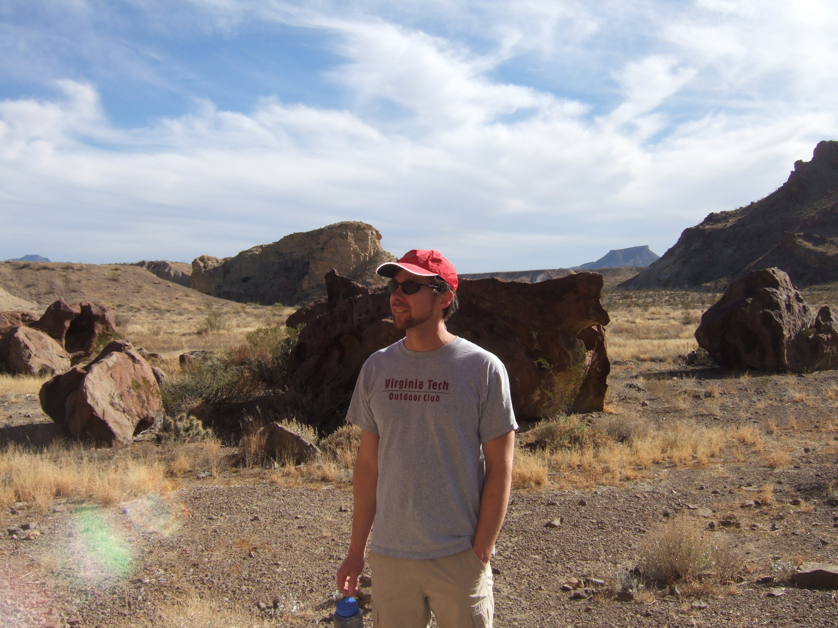
Me, admiring the desert scenery on Indian Head Trail
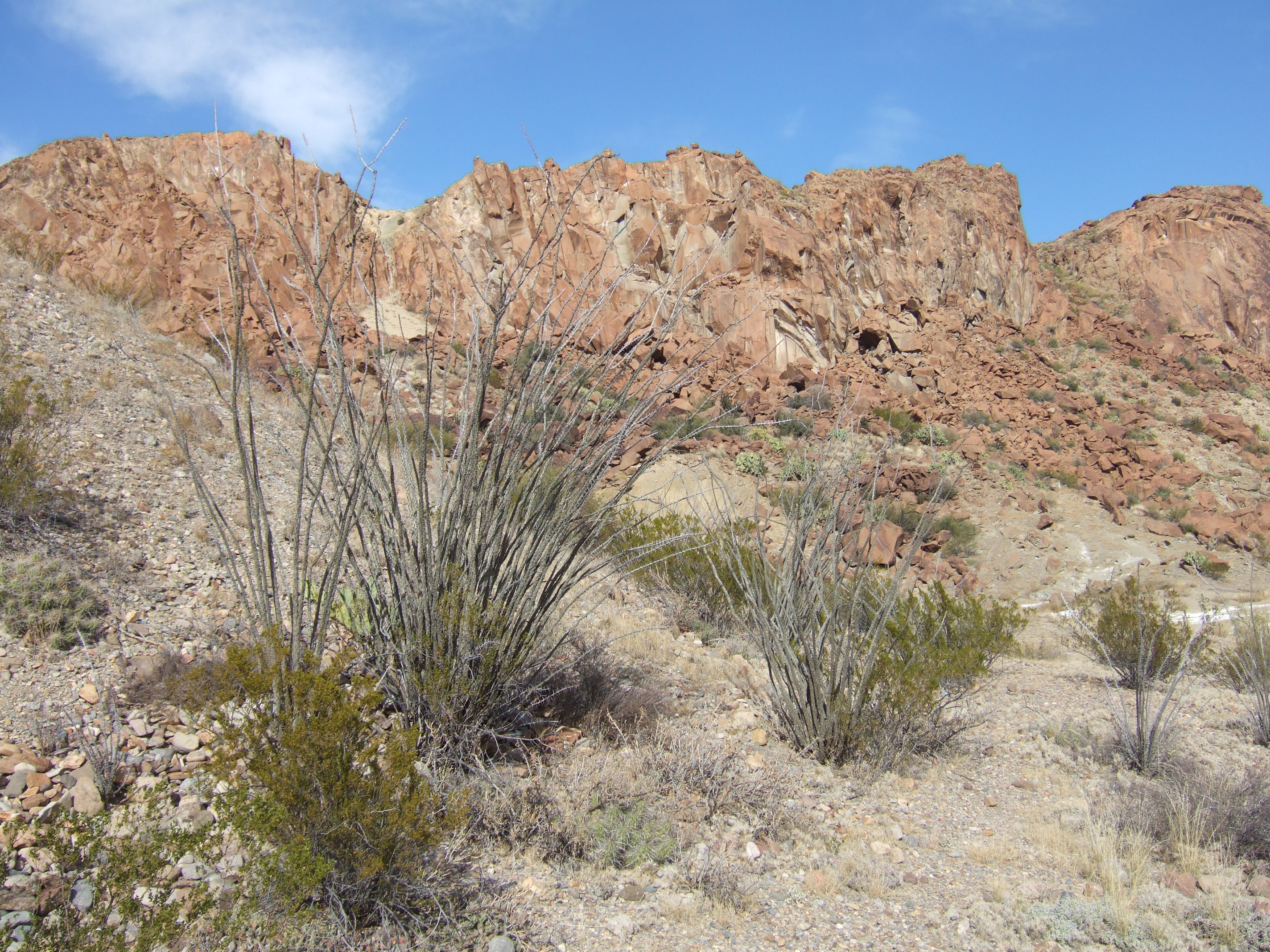
Portion of Indian Head Mountain
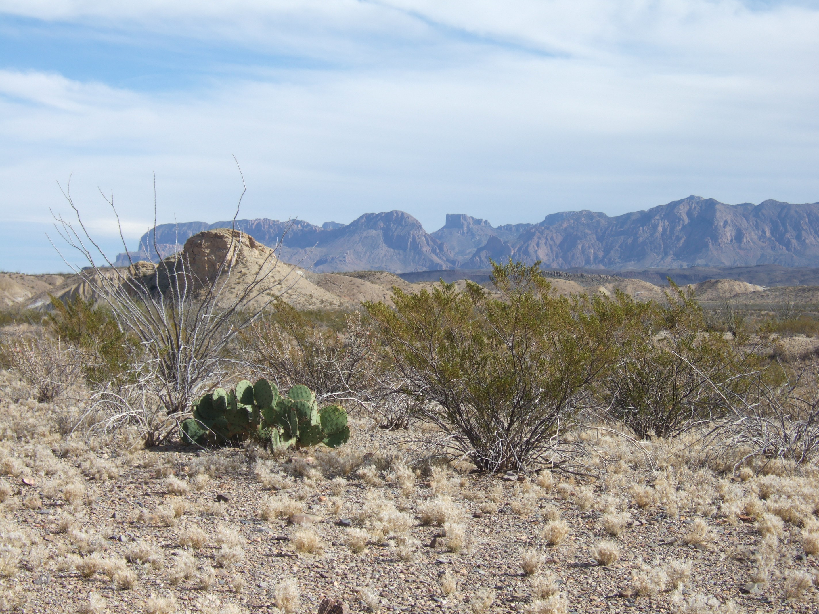
An Ocotillo, a Prickly Pear Cactus, and some Creosote Bushes frame a view of The Chisos Mountains
Time to Shove Off!
We arrived at Far Flung at 9 a.m. the next morning, eager to start our adventure. We confirmed our route and schedule one last time with our driver. The Boquillas Canyon section began at Rio Grande Village, the largest campground in the park (see map, last page). We planned to paddle six miles and camp at the entrance of the canyon the first day, paddle ten miles and camp within the canyon on day two, paddle twelve miles on day three, and finish the remaining five miles on day four, Christmas Day. We arranged a shuttle with Far Flung Adventures to pick us up at 9 a.m. on the day after Christmas.
Our driver, a middle-aged woman with bleached-blond hair and a deep, golden tan, gave us random bits of information as she shuttled us to the Rio Grande Village. She identified and pointed out some of the plants and cacti as we sped by them, adding interesting stories of their benefits; stories such as how some local residents used the Chaparral, also known as the creosote bush, to successfully treat what was supposed to be terminal cancer.
In addition to the area trivia, we also got to hear about her recent struggles with a bitter divorce and the accompanying child-custody battles that she had when living in California.
“I moved out here to start over,” she said while solemnly staring out the window. I felt bad for her struggles and wondered how she would survive financially in such a remote area with few job prospects. Lisa wished her good luck with her new endeavors.
When we arrived at the famed river that forms the border between the United States and Mexico, I was surprised with its narrow width. The Rio Grande, or The Rio Bravo del Norte, as it’s called in Mexico, flows over 1,800 miles, has a watershed that covers over 182,000 square miles, and is considered the fifth largest river in North America, yet I was looking at a waterway that was barely 50 feet wide. Perhaps its tiny appearance was exaggerated by the tremendously tall grasses that loomed from the shoreline. Or maybe, with the vast horizon that surrounded us, we were seeing an illusion of the stream’s narrowness, made insignificant by the expansive view of rock and desert. Regardless of what my mind tried to rationalize, I still expected more river.
Lisa and I stacked our gear into an orderly pile in the center of the boat. We wished our driver a Happy Holiday and shoved off the sandy shore. Our adventure had officially begun! I felt elated as we left the stability of solid ground and embarked toward the unpredictable backcountry.
Once paddling, we immediately had to contend with the persistent cold front that moved through the area that day. The strong winds shoved our boat around and kept us zigzagging down the river. Sometimes we lost momentum when a gust pushed us backwards. The cold, strong winds forced us to wear several layers of warm clothes along with our raingear (raingear makes an excellent wind-breaker). Our struggles to keep the boat straight also helped keep us warm.
I was surprised with the river’s strong current. I had read about the river’s weakened flow due to drought and poor water management. In the early 2000s, these conditions severely impaired the flow of the Rio Grande to the point that a giant sandbar formed at its mouth, preventing the river from emptying into the Gulf of Mexico for the first time in recorded history. The sandbar was removed and has since come and gone. I also read that small sandbars had accumulated throughout the course of the river on numerous bends, a fact that became critical to us later during our trip.
We traveled only about 100 yards before we encountered the first river-impeding sandbar. As the river serpentined around the outside bends of certain corners, sandbars created a narrow, fast-moving channel along the bank where it curved. These slender channels were generally littered with dead tree limbs and flood debris, and some were sheltered under brush and grasses that stretched straight out over the water.
Navigating these swift corners with a heavily loaded canoe was challenging. Not only did we have to manage the strong current flowing along the littered curve of the bank, but we also had to counter side currents that flowed across the river off the sandbars, another force that tried pushing us into undesired areas. To successfully paddle this narrow, swift river, we had to remain invariably vigilant to avoid being drawn into the grasses and shrubs that attempted to swallow us.
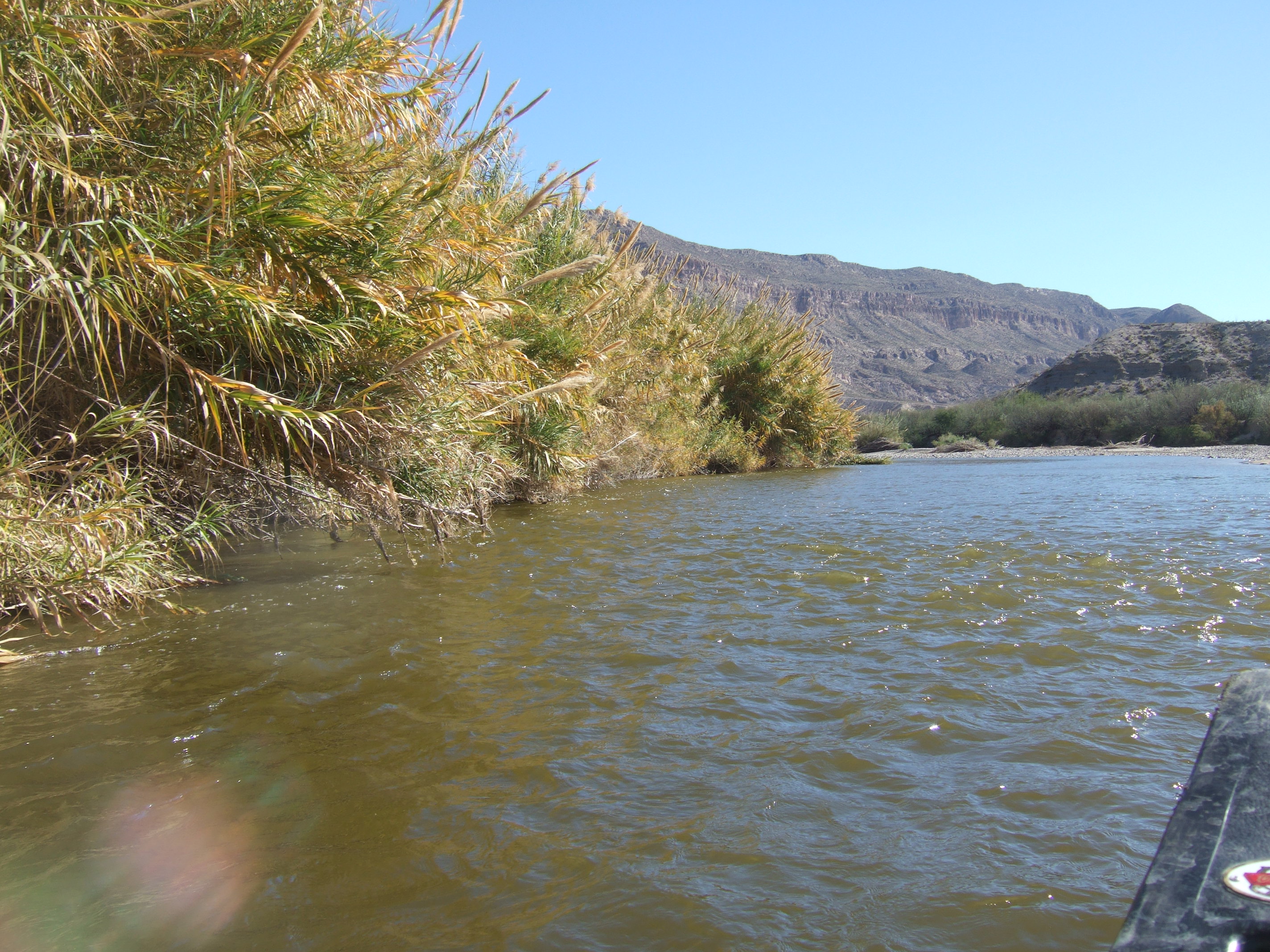
View of a channel created by one of many silt sandbars. The sandbar is on the right (out of view). The small waves on the right are from a side current flowing left across the river. The side currents were usually shallow and rocky. The main flow of the channel is on the left underneath the extended grasses. The next sandbar can be seen downstream on the right side of the river, creating another narrow channel on the left.
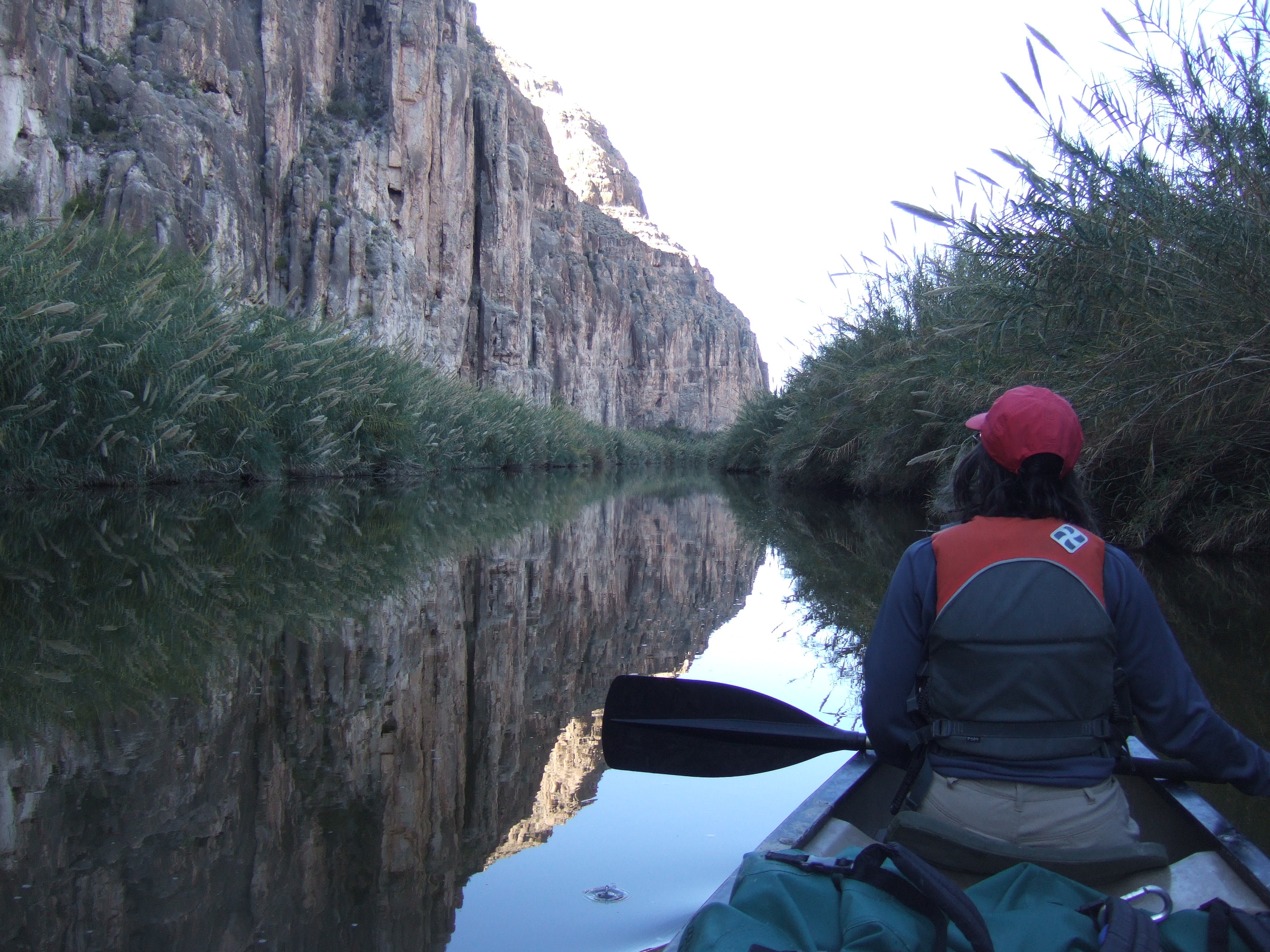
Paddling the first six miles to the entrance of Boquillas Canyon went well. Every now and then I grumbled when we had to fight the strong head winds or had to dodge brush and debris. However, our small inconveniences were eclipsed by the intense views. The scenery was absolutely breathtaking. At times, we floated alongside small cliffs; some sheer, some composed of rows of cracked, rock layers, descending directly into the river. Sometimes, lush vegetation and tall grasses crowded the banks, replacing the cliffs with a dense maze of foliage. The grasses towered over the river’s edge, reaching about ten feet high. Some stalks had tips of long, plume-like flowers; fluffy seed heads that gently jabbed at the sky. Behind the vegetation was the skyline of the jagged Boquillas Canyon. I was invigorated watching the canyon grow as we gradually approached it.
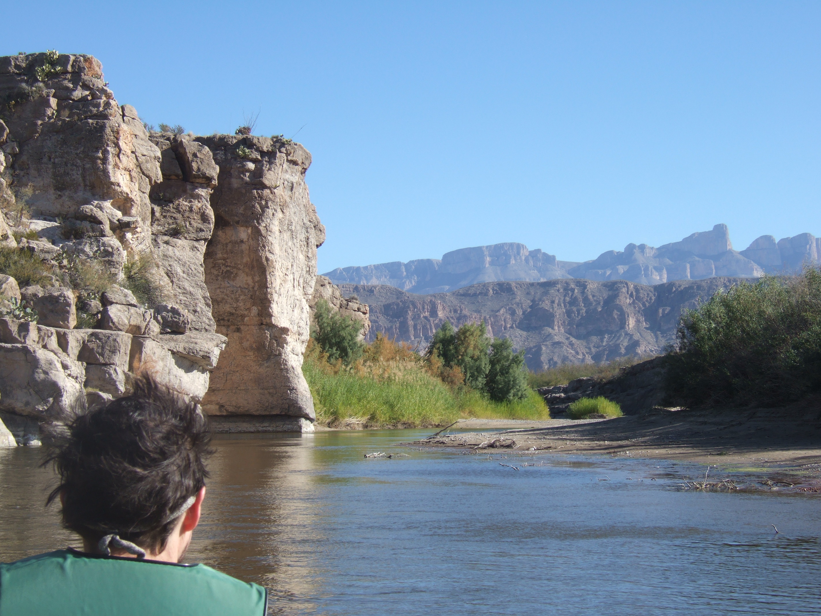
View of the distant Boquillas Canyon. The highest knob sticking up on the right side is part of a cliff that we eventually paddled along.
When we arrived near the entrance of the canyon, we pulled off onto the Texas side of the river to set up camp. We set up our tent and left the fly off, although we were fully aware of the chilly forecast. The fly is a layer of the tent that covers the screening to help retain heat and protect us from rain. We decided to sleep exposed under the screen so we could feel and breathe the desert’s night air.
That first night was clear and bright from the near-full moon. The cold front took its toll on us, providing strong winds and temperatures that dipped into the mid-twenties. Even without the fly to shelter us from the cold and frost, we slept comfortably in our sleeping bags. At times, though, I was awakened by a bitter, numbing sensation on my nose and cheeks.
The next morning, we admired the spiky designs of thick frost that covered our tent. We stretched and moved around to loosen our stiff joints while we waited for the sun to warm the environment. We took our time packing camp, knowing that the cold shadows of the canyon walls would prolong the chill in the air.
The Capsize
Around 10:00 a.m., we loaded our boat and prepared to shove off. Lisa changed into her river clothes; synthetic, quick-drying shorts and shirts and her river sandals. I expected a chilly breeze within the deep canyon walls, so I decided to wear my warm camping clothes and hiking shoes for the remainder of the morning. I would change into my river shorts and sandals soon after the motion of paddling warmed me up.
Just before we entered our boat, another canoe appeared from around the bend. It was a young couple; a small woman in front and a thin man in back, roughly similar to us in appearance. They were probably about ten years younger than us, judging by their strong and healthy posture and the smooth skin on their faces. When they reached us, we gave a quick wave of acknowledgment at about the same time they entered one of the narrow and swift channels created by a sandbar. We shouldn’t have distracted them; the man attempted to wave back, but the brief pause in his paddling caused their boat to overshoot the current and ram a pile of rocks just past where we were standing. They recovered well, and, after some quick adjustments, they pushed off with their paddles and sped away out of our sight.
I stepped into the canoe and stumbled my way over bags of gear, reaching the front of our boat. While I got accustomed to my chilly seat, Lisa, with one foot in the boat and one on the bank, pushed us off to begin our second-day’s course. We paddled only about fifty yards before we arrived at a sandbar that created a fast current along the left bank. I paddled toward the channel while balancing our camera on my thighs, ready to capture the canyon scenery that was about to engulf us. As we entered the channel, I noticed two small, white branches poking about twelve inches out of the water in our path. I stopped paddling to analyze their threat. I decided, judging by the size of the branches and the speed we were going, that we would push over them and continue on. Lisa, in the meantime, decided differently. She yelled for help while she tried to clear the branches by steering the boat out and around, but she was unable to do so successfully without my continuous paddling. Once realizing what Lisa was trying to do, I paddled vigorously to help her turn our boat away from the branch’s position, but it was too late. The two rigid sticks didn’t budge as they grabbed hold of the center of our canoe, stopped us in our path, and forced our boat to turn sideways. The strong current took only seconds to build water on the upstream side of our boat. The mounting water slowly pulled the edge of our canoe down, tipping the boat and demanding its contents. We tried to counterbalance the force, but the angle just kept increasing. Lisa watched as bags and supplies fell out of the boat, then more bags, then me, and then all the rest, spilling into the river’s swift channel.
As my head went under, I got to hear what most backcountry paddlers try to avoid; the muffled sound of bubbles under water. The first thing I thought as the cold water penetrated my clothes and nipped at my skin was that my only warm camping outfit and shoes, which should ideally be packed in a dry bag – were now wet. That wasn’t exactly a thought of desperation, but more a brief reflection of inconvenience.
Once I surfaced and got my bearings straight, I was visually reminded of our situation. That’s when I truly started to feel desperate. The first thing I saw through the sheen of water on my sunglasses was our hoard of gear spread out across the river. With an alligator’s view, my eyes watched all of our belongings bobble freely in the water while being carried off in the current. The colors littered the river: reds, yellows, blues, greens, all spread out over the surface like a toy sailboat race. The gap between us and our gear slowly widened as we both held onto the boat that was completely full of water. The top of the gunwales was the only part of the canoe that was above the water. I feared the canoe was going to sink, so I tugged upward to roll some water out, but with no success.
A submerged boat retains few of its desirable properties. For one, it becomes belligerently heavy and unwieldy. At this particular bend where we capsized, the river became deep, and as we floated downstream, we could only tug at the barely buoyant canoe that plowed down the river like a stubborn barge. My desperation increased as I felt a numbing sensation on my skin. I also noticed that Lisa was breathing spasmodically – one of the symptoms of cold shock, a physiological response that occurs when your body is suddenly submerged in cold water. We needed the boat to survive, but we also needed to get out of the water.
Lisa asked, “What do we do?”
I noticed a cleared, muddy bank on the Mexico side of the river that was followed with a calm pool of water.
I gestured toward the clearing. “Let’s get the boat there!”
Beyond the muddy bank was a long stretch of shore that was inaccessible, cluttered with heavy growth of shrubs and tall, thick reeds. If we don’t get this boat to that clearing, we’ll have a rough and dangerous recovery! I frantically kicked and swam with the boat, pulling, slowly shuffling it across the river.
“We’ve got to get to that bank!” I grunted urgently as we continued fighting the heavy canoe.
My feet found the river’s bottom, which gave me the leverage I needed to yank the boat to the calmer water. We dragged the boat through some deep, sticky mud, away from the river’s current. I paused a moment to catch my breath and give my numb muscles a break. That’s when I looked downstream and saw our colorful collection of dry bags and gear disappear around a corner out of our sight. I gained a new sense of urgency as I realized we needed to regain control – fast! It seemed like a slow, long struggle to heave the heavy canoe onto the mucky shore, and then, while stumbling in the deep, thick mud, attempt to flip it. Eventually, the suction of the mud that gripped the bottom of the canoe gave way, allowing us to pour the water back into the river.
Taking quick stock on the bank, we had both paddles, one food cooler, one two-and-a-half gallon jug of water, and one of Lisa’s blue dry bags that was packed with her clothes. These items weren’t enough for us to survive in the desert the next three nights. We threw what we had into the boat and shoved off. Our mood improved as we took charge and aggressively paddled to retrieve the rest of our gear.
We paddled around the next bend to find most of our belongings resting in a deep pool that was created by a backlash. We ignored the gear that was floating in the eddy and continued paddling to recover the few items that were still escaping down river. I navigated the boat while Lisa snagged and heaved dripping bags out of the water. We then worked our way back up river to our remaining gear that sat in a deep pool next to a convenient sandbar. I dropped Lisa off to sift through and analyze the gear while I gathered the remaining items that were still floating around.
We lost only one two-and-a-half gallon jug of water and one of Lisa’s beloved old Chaco sandals. The sandal had been through years of adventures and seen many places, and Lisa felt that losing it in the Rio Grande was a sad but fitting end. I would have been concerned, actually screwed, if I had lost one of my shoes. But Lisa, who errs on the side of caution, rummaged around in one of her bags and pulled out a brand new pair!
Although we recovered most our gear, it did not all remain dry. Two of our large dry bags failed. One of them included a day pack that contained gear like binoculars, sunglasses, headlamps, and other small camping items. The day pack was rather heavy and positioned towards the top of a large dry bag, causing the rolled-up side of the dry bag to flip underwater. As experienced paddlers know, submerged dry bags are susceptible to failure. Unfortunately, my sleeping bag was in that submerged bag and had gotten quite waterlogged. The foot end of Lisa’s down sleeping bag also got wet along with some of her clothes. In addition to our wet gear, all my warm clothes were wet, and the only usable shoes I had left were Teva sandals. I was concerned that these losses might pose a problem the next few nights when temperatures were expected to dip below freezing.
No Turning Back
Our thoughts turned to our discomfort of being cold and wet. We stripped naked to dry off and let the sun warm us. While sorting through our gear to quarantine the wet stuff, I looked up and saw a tourist, about thirty feet directly above us, scanning the horizon with binoculars. It turned out that the sandbar we were on was located directly beneath Boquillas Canyon Overlook, a good spot for tourists to get out of their cars and take in the view. I felt strange being naked in full survival mode while the man on the cliff above us casually looked around while comfortably dressed in leisure wear. I hoped our nakedness didn’t add to his view, but we ignored him. We were behind schedule and needed to recover from our capsizing to make it to our next campsite before dark.
I looked ahead to our destination. The entrance to Boquillas Canyon was just one-hundred feet away. We were about to enter a new dimension of the trip, a factor that we had just gained some uncertainty with. Once we enter the canyon, there will be no easy way out and no turning back. We will have to successfully paddle the next three days and make it to our final destination on schedule to meet the outfitters, because there is no way for us to climb out of the canyon and no way to reach help by phone. This is exactly the type of isolation we sought on our adventures, but our confidence was shaken by the capsizing.
We didn’t spend much time thinking about it. We repacked our belongings, ignored our doubts, and continued our journey. Although our confidence was shaken, I was glad to see our spirits were still high. The capsize we just endured already seemed like a distant memory. Maybe our minds moved forward because we knew that spending time dwelling on our misfortune would add to our prolonged delay, or perhaps our minds cleared because we were about to enter the most stunning portion of the trip.
The cliffs that rose from both sides of the river at the entrance of the canyon acted as a colossal gate, towering over us, yet granting us permission to enter a magical world. The beauty, serenity, and intensity of the sheer cliffs struck me as we avidly entered the canyon. Some of the cliffs went straight up from the water, hundreds of feet. Some gleamed brightly from being struck by the angled sun, while others hid in the shadows. The knobby, rock walls were a light-tan color, giving way to dark-brown smudges that covered the rounded peaks. The tops of the walls harbored desert growth, but the plants were too far away to identify them. They gave the peaks a blurred, stubbly appearance. Occasionally, we saw vegetation growing out of long, vertical crevices, feathering the weathered, dull cracks with greenery. The plants were clinging on to nooks and crannies, surviving with limited resources. Most of the cliffs were sheer drops that had loose rubble piled at their base, leaving just enough room for a row of tall, lush foliage to line the river’s banks. In the heart of the canyon, some of the walls reached 1,700 feet above us. The beauty of the massive rock walls and formations went well beyond my expectations.
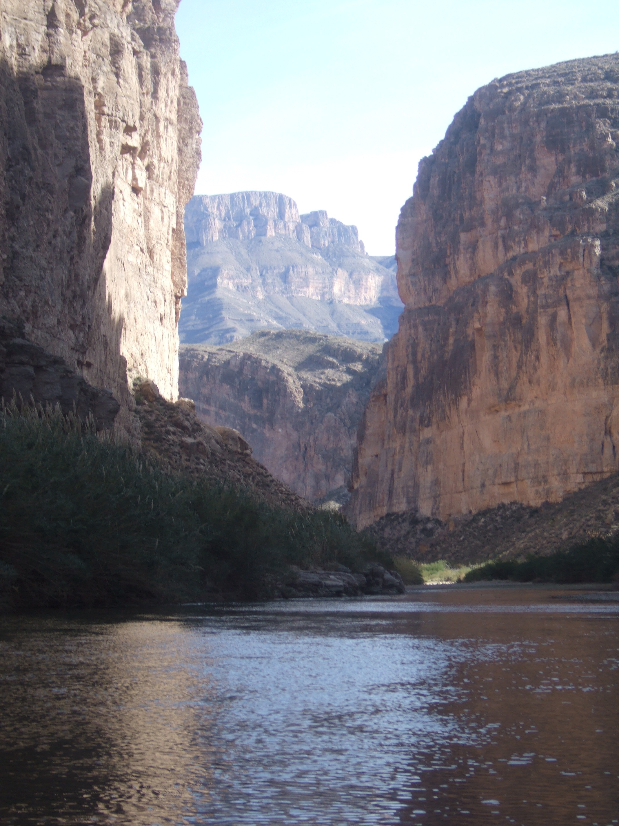
View of the rugged terrain shortly after entering Boquillas Canyon
We didn’t have many camping areas to pick from within the canyon’s walls. On our second night, we were supposed to camp at a beach-like area on the Mexico side of the river, but it was still far away. We wanted to cut the day short so we could lay our clothes and sleeping bags out to dry in the sun. We found a small island on the Mexico side that provided a convenient spot. We climbed a narrow, muddy trail to a flat and elevated clearing. I noticed a small portion of the island looked freshly mowed, which seemed impossible in this remote area. I guessed, judging from the several piles of dung, that horses or mules were responsible for the convenient neatness. We immediately got to work drying our clothes by running a line between two trees. We didn’t have much time before the sun would disappear behind the high walls surrounding us.
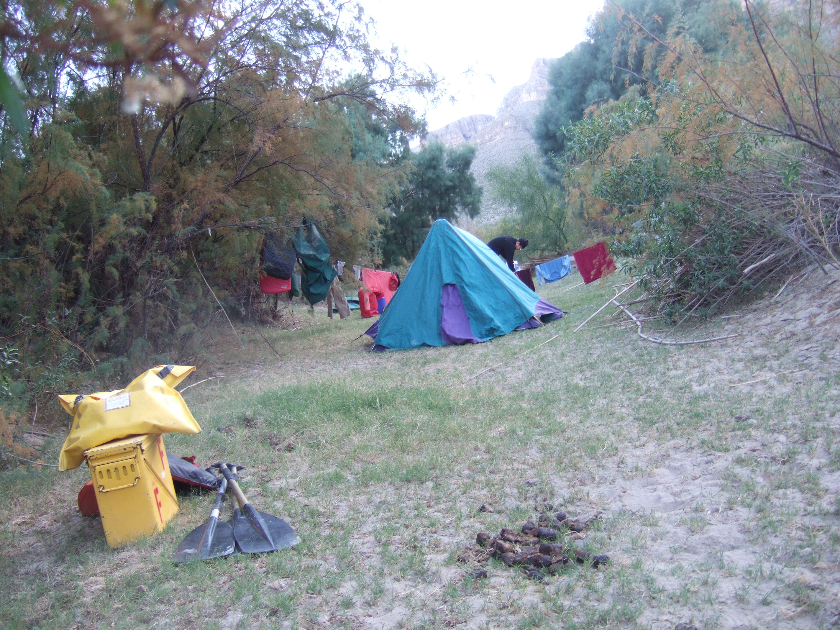
Attempting to dry our gear on our second night. Yellow portable toilet box in foreground. Poo beside it not ours.
That night, we adapted to the loss of my sleeping bag by sleeping with extra clothes and using Lisa’s bag as a blanket over both of us. We assiduously avoided the wet part of it – that is, while we were awake. As with the previous night, the near full moon brightened the night sky. It was as if a car’s headlight shined in our tent all night. The overnight temperatures dipped into the upper twenties again, but the thick layer of frost didn’t find us as with the previous night, thanks to the protection of some tree branches that loomed over our tent.
On the morning of day three, we started paddling early to make up for the lost miles from our altered schedule. We didn’t paddle very far, maybe a half mile, before we encountered the other canoe that we saw the day before. It appeared they had just recovered from capsizing. There was a difficult, swift channel on the right side of the river followed by a sandy bank on the left where they were positioned. They were shuffling through gear and wringing out clothes. We had a brief moment to chat as we sped by. We all agreed that it was a demanding and merciless river.
During the times when we weren’t managing the narrow bends in the river, we absorbed the gorgeous views and observed the wide variety of wildlife. With the diverse eco-systems, Big Bend is home to more types of birds, bats, and cacti than any other national park in the United States. The area is a major migratory route that attracts about 450 different species of birds throughout the year. Some of the species we saw included road runners, varieties of herons, songbirds, such as cardinals and swallows, and several predatory birds, such as the peregrine falcon. The falcons were usually perched on top of short cliffs, looking down on their small, impending victims. Twice we witnessed the falcons making an attack. The small songbirds whipped themselves in several directions as the majestic raptors honed in. In both cases, the songbirds disappeared into the shrubs, successfully avoiding the falcon’s deadly grasp.
In addition to the numerous bird sightings, we also saw several horses and mules, with some mules delicately balancing themselves on narrow ledges within the vertical cliffs. At one point, we watched a scroungy-looking jack rabbit, with its excessively long, skinny ears, gaiting through scrub along the shoreline. Along some areas, we noticed evidence of beavers, and during some of our stops, we saw many bobcat and raccoon tracks. We read during our planning that mountain lions roamed the area. Lisa carried a small club in case of an encounter, and seemed almost thrilled at the prospect, but we ended up using it only to drive tent stakes.
It was on day three when we exited Boquillas Canyon, and it happened all too soon. Although, while looking behind me, the sights of the canyon were still spectacular, I was saddened to see the mountain range slowly grow distant as we floated down river. The paddling conditions that day were ideal. The river deepened and provided long stretches of relaxing flat water. The winds were light and variable, the clear sky provided abundant sunshine, and the temperatures warmed up to what felt like the seventies. The day truly was perfect. It was also our longest day of paddling, since we had to return to our original schedule.
Late that afternoon, we arrived to our third camp area that was located on another island. The island, which split the river into two tiny streams, began with a wide, flat area that was covered with small, smooth rocks. The oval-shaped stones contained different shades of browns, tans, and reds. I suspected, by their cleanliness, that they were usually submerged. The colorful collection of rocks stretched about thirty yards before giving way to a higher grassy area where we chose to set up camp. We unloaded the canoe, set up camp, and spread out our still-damp belongings in the sun for further drying. Since we were out of the canyon and there were no high cliffs to block the sun, we enjoyed longer access to the direct sunlight.
It was a peaceful afternoon. We kicked back in the warm sunshine – no worries, no schedules, nothing to do but relax. We explored the entire island, looking for wildlife, animal tracks, and plant life. Past the high, grassy area where we set up camp, the island contained sections of thick brush and vegetation. The soft sand, piled thick and deep in some places, gave way as we stepped down from the higher ground to the shoreline. We found some animal trails that we followed through a maze of shrubs, leading us to random areas. The sets of tracks that we saw in the sand appeared to be from raccoons and bobcats.
Later that evening, Lisa suggested we have a fire to celebrate Christmas Eve. This came as news to me: I lost track of time and forgot about the holiday. Our celebration consisted of a tiny campfire on the rocks next to the river. There was no wind, so the small flames danced peacefully as their flickering numbed my mind. The sunset and moonrise were as stunning as they had been with the previous nights. We stayed up later than usual, until about 11 p.m., enjoying the warmth of the fire under the clear sky. Our desert landscape consisted of a 360 degree view of an immense, nighttime panorama that was lit with the silver glow of the bright, full-moon light.
We awoke to another impressive layer of thick frost. The winds died down, so the morning air lacked the intrusive wind chill that we experienced the previous mornings. Knowing our time for this trip was coming to an end, we slowly packed our gear and enjoyed the sights of our surroundings. The early-morning sunlight provided intense views by reflecting off the distant canyon walls, causing us to savor as much of our environment as possible. We weren’t in any hurry to leave because we knew it would take only a couple of hours to paddle our last five miles. We felt a bit anxious, though, since we were aware of the class II and III rapids still ahead.

View from our third campsite of the sunrise reflecting off Boquillas Canyon
Coming up in our last day’s paddle was Black Gap Rapid, the largest rapid in the Boquillas Canyon section. Our guidebook described it as a class III with rocks in the middle that created obstacles nearly impossible to avoid. It also stated that this rapid is easy to line. Lining a rapid involves getting out and walking along the shore while guiding the boat with the bow and stern lines. We had never “chickened out” and lined a rapid before, but, given our previous difficulties, we planned to be safe and give it a try.
We arrived to a beautiful, sheer cliff on the Texas side of the river. The 50-foot cliff had an attractive color combination of black and tan, decorating the layers of rock that ascended away from the river. We rounded the edge of the cliff and were greeted with the sound of the rapid’s roar, which increased in intensity with our gradual approach. The cliff provided very little space for the narrow row of vegetation and grasses that reached out over the water. The Mexico side of the river consisted of a large, flat rock garden that was exposed by the low water conditions. Girded by the rock garden, the river became extremely narrow as it snaked its way around towards the cliff, packing all its force into a narrow, swift chute.
We docked on the rock garden, each grabbed a line to secure the boat, and then stumbled along the lopsided rocks while guiding the canoe down the shore. Lining a rapid felt like having an adventure book opened before us that we were simply reading. As we proceeded along safely from one end to the other, we watched the water undergo many difficulties and thrilled to imagine what would have happened had we been in it. In the most technical part of the rapid, we saw at least two large rocks jutting out of the water within the swift channel as it curved around. A kayak may have had a chance to avoid carnage, but paddling through with a heavy canoe would have been virtually impossible, at least at this water level.
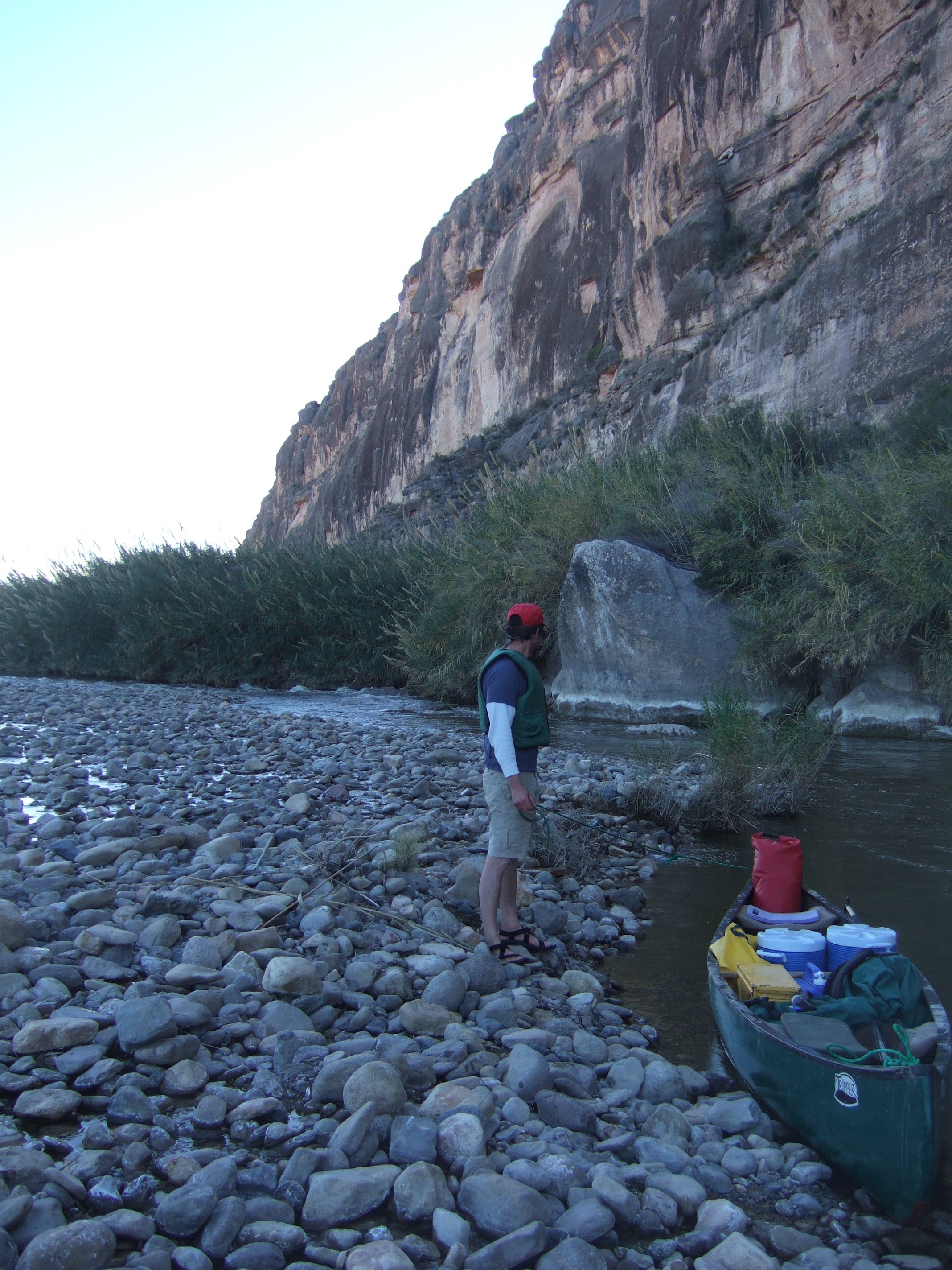
Me, holding the stern line while looking back at Black Gap Rapid

Admiring the scenery while taking a break near Black Gap Rapid
View of the calm waters following the rapid
Black Gap Rapid was our last obstacle. We had just one mile remaining before our trip ended at La Linda, another abandoned mining town. The afternoon was gorgeous on this Christmas day. The temperatures felt like the low seventies, and the winds were light and variable with clear skies.
When we arrived at La Linda, I was surprised to see a closed, heavily barricaded bridge. From the Texas side of the bridge, the barrier gradually grew with intensity, a call of arms that went unanswered on the Mexico side. Would-be crossers from Texas would have to abandon their cars at the first of six concrete barriers, and then they would have to climb a chain-linked fence, about six feet in height. Upon clearing that, they would be faced with a huge chain-linked fence, possibly twenty feet tall. To prevent crossers from simply going around this fence along the edges, the fence protruded several feet off the sides of the bridge, with the top and sides angled toward Mexico.
I later learned that the bridge was closed in 1997 to combat the heavy smuggling of illegal immigrants and drugs. The bridge’s closure created the longest stretch of border without a crossing, extending almost 400 miles. The closed bridge has negatively affected the local economy, and, since 2003, the local governments for both Texas and Mexico have been urging the U.S. Federal Government to re-open the bridge. The community used to thrive on both sides of the river here, but the continuity of the building’s abandonment from one side of the bridge to the other was rendered by this border policy that neither side of this ghost town was strong enough to withstand alone.
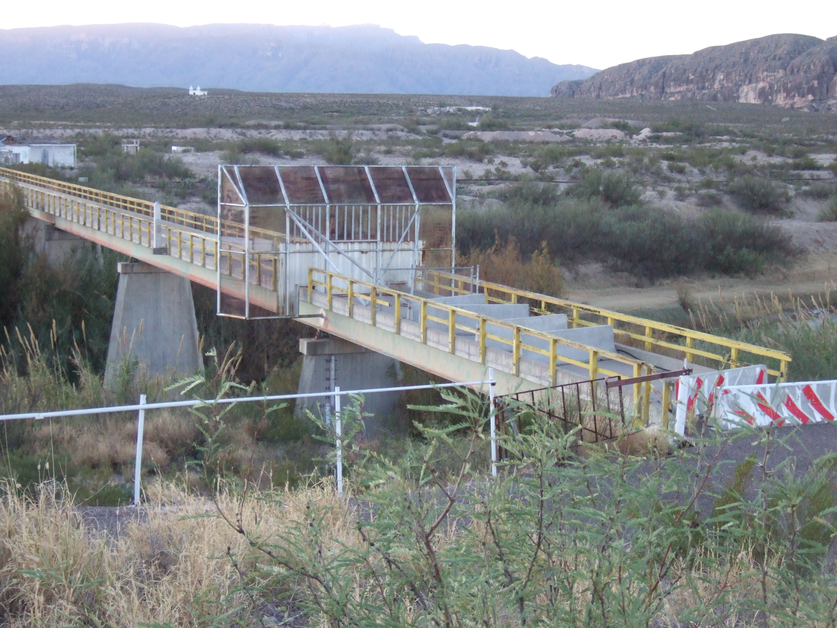
Barricaded bridge at La Linda
Fred the Guardsman
We passed under the bridge, docked our boat on the rocky shore, and started unloading our gear. I noticed a ragged, red pick-up truck that was parked about one-hundred yards down river. It looked like the owners just unloaded a small, flat-bottomed boat that was resting on the river’s shore. A large woman, who appeared ready to shove off, sat on the bench seat in the front of the aluminum boat. While we carried our gear up to higher ground, we did not go unnoticed. A man jumped into the truck and sped over toward us, leaving a dust trail lingering over his tracks. The truck came to a stop near us, abruptly ending the crunching sound of stone and gravel.
The man got out of his truck. “How you all doing?” he asked as he briskly walked toward us.
“Fine,” said Lisa, sort of as a question.
“Doing great,” I replied, while keeping a watchful eye.
“I’m Fred. I guard the property here. You camping here tonight?”
“Yes, we’re planning on it,” said Lisa, who seemed to have decided on a policy of friendliness.
“I’ll need $4.00 per person.” He peered up-river and asked “Anybody else in your group?”
“No, just us,” I said. “The outfitters didn’t inform us of any camping fees here.”
“Outfitters? They probably already charged you the fee. I’ll collect from them in the morning,” he stated with confidence.
Fred seemed desperate to be paid. I imagined sources of money were scarce for him out in this location. I didn’t admire what seemed to be his impoverished finances, but I did have a curious envy of his isolated life.
There was nothing unusual about Fred’s appearance. His round eye-glasses hung over top his slightly red face, and he sported a bushy goatee and mustache that covered his lips. His clothes were typical for what you would find in the country. His medium build was hidden under a light-weight, flannel shirt, unbuttoned and exposing a white tee-shirt that his belly gently pushed out on. He wore a pair of old blue-jeans, dirty tennis shoes, and a baseball cap. He was overly energetic for a middle-aged man, excessively talkative, as if he had just slammed a pot of coffee. We spent a few minutes chatting about the area that he guarded. I didn’t find out exactly what he guarded, only that he worked for the mining company that still owned this land. Since all of the buildings on both the Texas and Mexico side of the river were abandoned, I assumed he kept a lookout for smugglers and drug runners. When I asked him about the local economy, I saw his eyebrows knit with resentment.
“That idiot Clinton claimed it would be cheaper to ship stuff from China than crossing the Mexican border with that NAFTA bullshit.”
Both Lisa and I laughed as I nodded my head in agreement. He made a couple more arguments discrediting NAFTA before I asked him about his boat ride.
“Yeah, me and my old lady are heading out to fish for some channel cats. I’ve caught some monster cats out there. Big, big cats! Want to see some pictures?”
“Sure!”
We walked over to his pick-up truck. I noticed in the bed some old, rusty tools and other random pieces of tarnished metal, and a lot of empty beer cans – I think Bud Light. He opened his truck door with a loud creak, reached up into his dusty visor, and pulled out four faded and slightly smudged Polaroid pictures of him holding some big catfish. Some of the fish were so big that he had to lean back to support their weight.
“Wow, these are impressive,” I said.
“Yeah, fishing’s great out here,” he proudly claimed.
Fred described all his catfish pictures in detail, along with telling us some brief fishing stories. After showing us the pictures, he hopped in his truck and started it up.
He leaned out his window and said, “You all have a good night camping out here. I’ll be having a fire at the house up on top of that hill there tonight.” He pointed to his trailer that was about a quarter-mile away. “You all are welcome to come up for a drink.”
Then he revved his truck and sped away, leaving another trail of dust that lingered in the air. Moments later, we heard the sound of his boat engine. The high-pitched hum of the outboard motor slowly faded away.
Last Night in the Desert
The area became quiet after Fred left. I wondered why nobody else was using the boat launch, but then I remembered, it’s Christmas Day. We weren’t thrilled about spending our fourth and final night along the Rio Grande in essentially a sand parking lot. We investigated the area and chose to camp on a sandy, beach-like area to reduce our impact on the strands of dry, scraggly grasses. Once we set up camp, we evaluated our gear. I was surprised to find we still had five gallons of water remaining. That meant we basically carried forty extra pounds of water that we didn’t need, and that amount didn’t include the twenty pounds that we lost in the capsize. I know the locals, including the outfitters, warned us to carry that much water, and I know it’s important to heed locals’ advice, but I couldn’t help but wonder if this extra weight contributed to our capsizing. The reason we capsized was because we let our boat get stuck and turned sideways in the fast current, but perhaps the extra weight was a factor because it restricted our corrective measures.
After nightfall, we watched Fred’s large trashcan fire from our campsite. I wondered if Fred always invited tourists to visit, and if he did so because he was lonely. I was disappointed we didn’t have the energy to take Fred up on his invitation; he seemed like an interesting fellow who would have been fun to visit. But we were exhausted and ready to call it a night. As I slid into my sleeping bag, I remembered this was the first night I was able to use my sleeping bag since our capsizing.
Around 2 a.m., I was awakened by the tent flapping against my face. The wind outside howled as it shook the tent. I looked over to Lisa to find she was already outside investigating the scene. A windstorm had kicked up, and our tent stakes didn’t hold well in the deep sand. Lisa popped her head inside the tent and suggested we move to a nearby tree line that followed the river. There the trees would act as a windbreak, and the ground was more solid to hold our stakes. I resisted the plan of moving the tent; I was really comfortable and preferred the idea of sleeping it out. But after some pressure and prodding from Lisa, I grudgingly dragged myself out of my sleeping bag to get dressed.
I wasn’t sure what to expect as I poked my head out the tent. Our weather radio didn’t have reception the entire trip, so I wasn’t aware of any developing weather systems. Once outside, I was surprised by the wind’s warmth and to see a clear and starry sky. I also wasn’t expecting the painful sting of the sand as it persistently whipped my legs while we made our adjustments.
By morning, the strong winds were a memory and had returned to light and variable. We packed camp and uncovered our gear that the wind had maliciously buried in the sand. Our shuttle driver showed up at 9 a.m., right on time. When I first saw the car appear around the bend, zipping toward us, I felt both relieved and sad. I was relieved that there were no complications with getting back, but I was sad that we were about to leave the backcountry and return to civilization.
As with most of our other outdoor expeditions, I found the isolation, serenity, and the deep beauty of nature peaceful and relaxing, and I also found the unpredictability of the river and the wilderness mysterious and exciting. I thought about how I would miss the feeling of the desert sun on my skin, the visual diversity and intensity of our surroundings, the sounds of the wildlife and the flowing water, and the moments of deafening silence. I knew we would carry the memories with us for a long time, but the actual sensations will be gone once we leave the area and return to our busy lives back home. We did, however, still have a week allotted to drive back – time enough to explore other areas of Texas and the coast of Louisiana along the way. This provided ample road time to discuss the rewards – and lessons – of our experience, and to enthusiastically plan our next adventure.

That’s quite an adventure you had! My husband and I went there on our honeymoon (1996) – we didn’t do any boating but we did have some guys row us across the river and ride burros into the little village of Boquillas, where 3 burritos cost us $1. Stopping by to check out your blog after the writing group last week! You take beautiful pictures.
Thanks, Lisa. Your burro ride to the village sounds fun. We considered riding to a village across the border for some good food, but for some reason we were in a rush to get to Austin. I hope you enjoyed the writing group last week!
Hi, I want to subscribe for this blog to obtain most recent updates,
therefore where can i do it please help.
At the bottom of each page is a blue button that reads “Follow”. Click on that, and you will be notified of new posts via email.
It’s difficult to find knowledgeable people on this subject, but you
sound like you know what you’re talking about! Thanks
Thanks for sharing this – a fantastic read! I’d heard a bit about your and Lisa’s trip before, but never all these details. WOW, what an adventure! It’s also really well written (to me at least) and totally fun to read 🙂
Nice pics on your site, love the macro’s so fun.
Well…..hold on for a little bit if criticism. 🙂
You do have a knack for writing I’ll give you that, but definitely not for survival! Boquillas Canyon is an EASY paddle. You embellished a lot. And you might have scared away potential newcomers who have better paddling, camping, and survival skills than you two have.
Most importantly….before launching, how did you not tie everything down in your canoe? What did you think would happen to your gear in the event of a flip? Seriously? There’s not one single wilderness river runner I know who doesn’t tie their gear down. (Using different length straps made just for this). If you lose your gear you could lose your life. If your gear and clothing get soaked you could lose your life. If you lose your canoe you could lose your life.
A Rio Grande “Lower Canyons” guidebook from the 1980’s said it best, “ The desert is like electricity, as soon as you lose respect for it, it can kill you.”
I’ve canoed Boquillas Canyon 8 times as well as the 83 mile Lower Canyons trip 14 times. So without sounding like a “safety Karen” it might benefit you to hear what I have to say.
I won’t berate you but I will scold you for putting yourselves
In danger by overlooking THE MOST IMPORTANT method of protecting your gear. Everything gets tied in!
The first night temps went down into the twenties, correct? And then you two flipped right away the next morning? And then you continued your paddling without drying everything out? And then you still don’t tie your stuff in?
Also, an fyi, you’re not allowed to camp on the Texas side (night one for you) before you reach the entrance to Boquillas Canyon.
A solid safety tip …… Camping on islands is not a great idea on desert wilderness rivers due to the possibility (although not too common) of flash flooding. On one of my canoe trips through Boquillas Canyon the river rose from 120 cfs to well over 4,000 cfs overnight! There was no rain while our trip took place, but over two inches of rain had fallen days before many hundreds of miles upstream. A group of five paddlers who camped a mile or so downstream from us had two of their three (not tied up) canoes swept away by the flooding. Boats must be tied up (bring 100 feet of rope).
.
Excuse me for chuckling at you wondering if the few gallons of “excess drinking water” contributed to your capsize by making your boat too heavy to steer properly. The answer is, “Lack of paddling skill” caused your capsize. You were in the bow at the time? The stern paddler messed up initially, however the boat should have never capsized. I won’t get into it, however it was a rookie flip, leaning upstream, instead of leaning hard into the obstacle that you broached on. No teamwork from the tandem paddling team either.
When you eventually caught up to the couple paddling in front of you, you write “We agreed that it was a demanding and merciless river.” Uh……no. That’s simply not true. It’s embellishing your skills (which were lacking) and potentially scaring people away.
Lots of good writing but much misinformation. And at the end of your trip you were wondering why there were no cars or no one launching their boats (by the way it’s not a parking lot). The answer is because THAT particular launch spot is for boaters starting the 83 mile Lower Canyons trip. Not many people are able or willing to commit to that 8-12 day expedition. It has real rapids and isolation.
Keep on writing…..you do have a way with stringing words together to paint pictures in people’s minds. Just tie your shit in, and also it might benefit you to get a little bit of paddling instruction.
Fred has passed on. He was an incredible character.
Everyone loved Fred.
I won’t berate you but I will scold you.
There is nothing but trouble guaranteed for boaters that don’t tie their gear down. Seriously? A wilderness canoe trip and you capsize and all your gear is floating down the river? EVERYONE straps their stuff down! If the weather turned cold, and you lost sleeping gear, or got everything soaked in a capsize….you could be in big trouble. If the water level were high you wouldn’t have retrieved half of it….and only gear that ended up in an eddy somewhere far downstream.
No, the extra few gallons of drinking water DID NOT negatively affect your ability to maneuver your canoe causing you to broach it. Taking some paddling instruction would benefit you. That broach should never have resulted in a swim at low water levels in Boquillas Canyon. When the boat got sideways you both leaned the wrong way.
Lots of embellishments, but good writing skills. The Boquillas Canyon trip is not at all difficult at low water. You are scaring people.